
1954 Map of Candle B-1
USGS Topo · Published 1965About this map
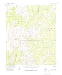
The Continental Divide winds through this interior Alaskan wilderness, serving as the primary geographic spine that separates the western and eastern watersheds of the region. This 1954 topographic study, based on aerial photography from the mid-1950s, reveals a landscape defined by its river systems rather than human infrastructure. The Tagagawik River flows across the northeastern portion of the sheet, while the Inglutalik River and the Baz River drain the southwestern and southeastern corners, respectively. This map depicts the area under the administration of the Bureau of Land Management, with land lines representing unsurveyed and unmarked locations predetermined according to the Kateel River Meridian. The absence of roads or trails emphasizes the preservation of the natural drainage patterns across the divide.
Find a feature on this map
4 named features on this map. Tap any name to fly to it.
Don’t see what you’re looking for? This feature index may not catch every label — zoom into the map to look around manually.
Map Details
Editions of this 1954 Candle B-1 Map
2 editions found
Other maps of this area

1951 · Candle
USGS Topo · 1:250,000

1951 · Kateel River
USGS Topo · 1:250,000

1954 · Candle A-2
USGS Topo · 1:63,360

1954 · Candle A-1
USGS Topo · 1:63,360

1954 · Candle C-2
USGS Topo · 1:63,360

1954 · Candle B-2
USGS Topo · 1:63,360

1954 · Candle C-1
USGS Topo · 1:63,360

1954 · Kateel River C-6
USGS Topo · 1:63,360
1955 · Kateel River A-6
USGS Topo · 1:63,360
1955 · Kateel River B-6
USGS Topo · 1:63,360