
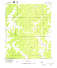
1954 Map of Candle B-2
USGS Topo · Published 1965About this map
The Continental Divide winds through this remote Alaskan interior, separating the drainage systems of the Seward Peninsula in the mid-1950s. The landscape is defined by its watercourses, with the South Fork Buckland River flowing northward in the eastern sector, while the headwaters of Kilusiktok Creek and Kilusuk Creek carve through the western ridges. These waterways served as the primary transit corridors for hunters and surveyors in an era when the land remained largely unsurveyed by the Bureau of Land Management.
Find a feature on this map
8 named features on this map. Tap any name to fly to it.
Don’t see what you’re looking for? This feature index may not catch every label — zoom into the map to look around manually.
Map Details
Editions of this 1954 Candle B-2 Map
2 editions found
Other maps of this area

1951 · Candle
USGS Topo · 1:250,000

1954 · Candle A-2
USGS Topo · 1:63,360

1954 · Candle A-1
USGS Topo · 1:63,360

1954 · Candle C-2
USGS Topo · 1:63,360

1954 · Candle C-1
USGS Topo · 1:63,360

1954 · Candle B-1
USGS Topo · 1:63,360

1955 · Candle
USGS Topo · 1:250,000

1955 · Candle B-3
USGS Topo · 1:63,360

1955 · Candle A-2
USGS Topo · 1:63,360

1955 · Candle C-3
USGS Topo · 1:63,360