
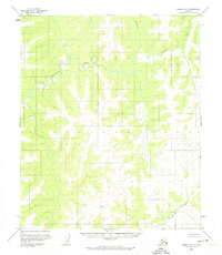
1954 Map of Candle A-2
USGS Topo · Published 1959About this map
The Inglutalik River carves a winding path through this portion of the Seward Peninsula, captured during a 1954 survey. Flowing from the northeast toward the west, the river defines a landscape characterized by deep drainage basins and significant elevation changes, with several peaks reaching over 2,000 feet. In the southeastern corner, the headwaters of the Ungalik River emerge, flowing toward the southern boundary of the quadrangle. This mid-century map, based on aerial photography from the late 1950s, reflects an era of remote topographic mapping in Alaska where the focus was on the raw geography of the terrain. The map confirms a lack of permanent settlements, roads, or trails at the time, leaving only the primary watercourses as the named landmarks for navigation or geological study in this uninhabited interior region.
Find a feature on this map
2 named features on this map. Tap any name to fly to it.
Don’t see what you’re looking for? This feature index may not catch every label — zoom into the map to look around manually.
Map Details
Editions of this 1954 Candle A-2 Map
2 editions found
Other maps of this area

1948 · Norton Bay
USGS Topo · 1:250,000

1950 · Norton Bay D-3
USGS Topo · 1:63,360

1951 · Candle
USGS Topo · 1:250,000

1951 · Norton Bay
USGS Topo · 1:250,000

1954 · Candle A-1
USGS Topo · 1:63,360

1954 · Norton Bay D-2
USGS Topo · 1:63,360

1954 · Candle B-2
USGS Topo · 1:63,360

1954 · Candle B-1
USGS Topo · 1:63,360
1955 · Norton Bay D-1
USGS Topo · 1:63,360

1955 · Candle
USGS Topo · 1:250,000