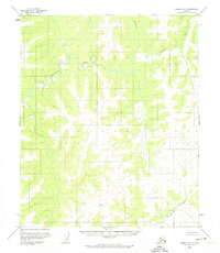
1954 Map of Candle A-2
USGS Topo · Published 1974About this map
Inglutalik River meanders across this northern landscape, defining a remote interior region of Alaska near the Seward Peninsula. Based on aerial photography from the mid-1950s, the map reveals a wilderness without roads or trails, where the drainage patterns of the Kilwaiktok Creek and the southern Ungalik River dictate the topography. The high point of the immediate terrain is marked at VABM 2181 Kila, a survey marker situated among the rising elevations that separate these river systems. This survey reflects the mid-century mapping efforts by the Bureau of Land Management and the Geological Survey to document the Kateel River Meridian during a period when much of this territory remained unsurveyed and unrecorded.
Find a feature on this map
5 named features on this map. Tap any name to fly to it.
Don’t see what you’re looking for? This feature index may not catch every label — zoom into the map to look around manually.
Map Details
Editions of this 1954 Candle A-2 Map
2 editions found
Other maps of this area

1948 · Norton Bay
USGS Topo · 1:250,000

1950 · Norton Bay D-3
USGS Topo · 1:63,360

1951 · Candle
USGS Topo · 1:250,000

1951 · Norton Bay
USGS Topo · 1:250,000

1954 · Candle A-2
USGS Topo · 1:63,360

1954 · Candle A-1
USGS Topo · 1:63,360

1954 · Norton Bay D-2
USGS Topo · 1:63,360

1954 · Candle B-2
USGS Topo · 1:63,360

1954 · Candle B-1
USGS Topo · 1:63,360
1955 · Norton Bay D-1
USGS Topo · 1:63,360