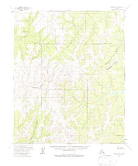
1954 Map of Candle B-1
USGS Topo · Published 1979About this map
The Continental Divide winds through this interior Alaskan wilderness, serving as a primary geographic spine between significant drainage basins. This mid-1950s survey captures the region in its raw, undeveloped state, where the headwaters of the Tagagawik River flow northeast while the Inglutalik River and Buck River systems define the southern and western slopes. The landscape is characterized by intricate contour patterns and numerous unnamed peaks, illustrating the complex topography of the Seward Peninsula hinterland before any modern infrastructure or road networks were established. A surveyed Base Line cuts horizontally across the northern section, representing early efforts by the Bureau of Land Management to organize this unsurveyed territory. The map provides an essential look at the natural hydrology and elevation gradients that have historically dictated travel and movement in this part of Alaska.
Find a feature on this map
5 named features on this map. Tap any name to fly to it.
Don’t see what you’re looking for? This feature index may not catch every label — zoom into the map to look around manually.
Map Details
Editions of this 1954 Candle B-1 Map
2 editions found
Other maps of this area

1951 · Candle
USGS Topo · 1:250,000

1951 · Kateel River
USGS Topo · 1:250,000

1954 · Candle A-2
USGS Topo · 1:63,360

1954 · Candle A-1
USGS Topo · 1:63,360

1954 · Candle C-2
USGS Topo · 1:63,360

1954 · Candle B-2
USGS Topo · 1:63,360

1954 · Candle C-1
USGS Topo · 1:63,360

1954 · Candle B-1
USGS Topo · 1:63,360

1954 · Kateel River C-6
USGS Topo · 1:63,360
1955 · Kateel River A-6
USGS Topo · 1:63,360