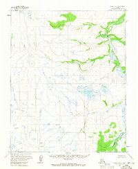
1954 Map of Candle D-1
USGS Topo · Published 1965About this map
The Tagagawik River winds through this expanse of the Kateel River Meridian, its broad meanders and oxbow lakes dominating the eastern portion of the landscape. This 1950s-era survey, based on aerial photography from the Bureau of Land Management Folio K-7, documents a territory defined by intricate drainage patterns and surveying monuments. Geodetic points such as Wrench North Base and Wrench South Base serve as fixed markers in a region otherwise characterized by shifting wetlands and unnamed tributary systems. The terrain transitions from the river valley into rising elevations, noted by landmarks like Andy and the Middle Fork. This map captures a moment when land lines remained largely unsurveyed and unmarked, reflecting the state of interior Alaskan surveying in the mid-20th century.
Find a feature on this map
5 named features on this map. Tap any name to fly to it.
Don’t see what you’re looking for? This feature index may not catch every label — zoom into the map to look around manually.
Map Details
Editions of this 1954 Candle D-1 Map
2 editions found
Other maps of this area

1951 · Candle
USGS Topo · 1:250,000

1951 · Selawik
USGS Topo · 1:250,000

1951 · Shungnak
USGS Topo · 1:250,000

1951 · Kateel River
USGS Topo · 1:250,000

1954 · Candle C-2
USGS Topo · 1:63,360

1954 · Candle C-1
USGS Topo · 1:63,360

1954 · Kateel River D-6
USGS Topo · 1:63,360

1954 · Candle D-2
USGS Topo · 1:63,360

1954 · Kateel River C-6
USGS Topo · 1:63,360

1955 · Shungnak
USGS Topo · 1:250,000