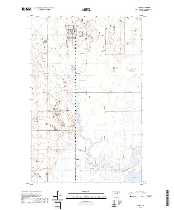
2024 Map of Cando
USGS Topo · Published 2024About this map
The town of Cando, serving as the seat of Towner County, anchor this prairie landscape of North Dakota. The map details the local grid of the town center, highlighting the Towner County Courthouse and several community burial grounds including the Independent Order of Odd Fellows Cem and the Sacred Heart Catholic Cem. To the south, the smaller settlement of Maza sits along the road network near the Olson Cem. The region is defined by its glacial prairie potholes and conservation areas, most notably the Towner County Waterfowl Production Area which provides protected habitat for migratory birds. In the southeastern corner, the northern reaches of Lake Alice indicate the low-lying hydrology typical of this part of the state, where agriculture and wildlife management coexist within the section-line road system.
Find a feature on this map
32 named features on this map. Tap any name to fly to it.
Don’t see what you’re looking for? This feature index may not catch every label — zoom into the map to look around manually.
Map Details
Editions of this 2024 Cando Map
This is the sole edition of this map. No revisions or reprints were ever made.
Other maps of this area

1953 · Devils Lake
USGS Topo · 1:250,000

1956 · Devils Lake
USGS Topo · 1:250,000

1957 · Cando SE
USGS Topo · 1:24,000

1957 · Cando
USGS Topo · 1:24,000

1957 · Cando NE
USGS Topo · 1:24,000

1957 · Churchs Ferry
USGS Topo · 1:24,000

1962 · Egeland SE
USGS Topo · 1:24,000

1962 · Egeland SW
USGS Topo · 1:24,000

1971 · Considine
USGS Topo · 1:24,000

1971 · Leeds NE
USGS Topo · 1:24,000