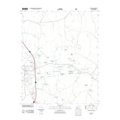
2011 Map of Candor
USGS Topo · Published 2011About this map
Candor sits at the western edge of this Montgomery County landscape, serving as a hub for a network of local roads that branch out into a region defined by its numerous small-scale water management systems. The terrain is crisscrossed by namesake waterways like Cabin Creek, Mill Creek, and Drowning Creek, which have been dammed to create local landmarks such as McCauley Pond and the Candor City Reservoir. These ponds and lakes often bear the names of local residents, including the Arthur Williams Dam and Ed Harris Dam series, providing a record of land ownership and agricultural engineering in the early 21st century.
Find a feature on this map
117 named features on this map. Tap any name to fly to it.
Don’t see what you’re looking for? This feature index may not catch every label — zoom into the map to look around manually.
Map Details
Editions of this 2011 Candor Map
This is the sole edition of this map. No revisions or reprints were ever made.
Other maps of this area

1942 · Troy
USGS Topo · 1:125,000

1949 · West End
USGS Topo · 1:24,000

1949 · Jackson Springs
USGS Topo · 1:62,500

1950 · Norman
USGS Topo · 1:24,000

1953 · Raleigh
USGS Topo · 1:250,000

1954 · Raleigh
USGS Topo · 1:250,000

1956 · Harrisville
USGS Topo · 1:24,000

1957 · Troy
USGS Topo · 1:62,500
1957 · Jackson Springs
USGS Topo · 1:62,500

1974 · Candor
USGS Topo · 1:24,000