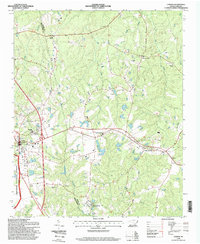
1994 Map of Candor
USGS Topo · Published 1998About this map
Candor and Eagle Springs anchor this mid-1990s survey of the sandy hills spanning the border of Montgomery and Moore counties. The landscape is a mix of agricultural clearings and forested tracts, notably including a portion of the Uwharrie National Forest in the west. Local community life is centered around numerous country churches like Flint Hill Church and Bensalem Church, alongside several unnamed cemeteries. The presence of Samarcand Manor State Correctional Institution and several large Sandpits indicates the institutional and industrial character of the rural corridor between the two primary settlements.
Find a feature on this map
36 named features on this map. Tap any name to fly to it.
Don’t see what you’re looking for? This feature index may not catch every label — zoom into the map to look around manually.
Map Details
Editions of this 1994 Candor Map
This is the sole edition of this map. No revisions or reprints were ever made.
Other maps of this area

1942 · Troy
USGS Topo · 1:125,000

1949 · West End
USGS Topo · 1:24,000

1949 · Jackson Springs
USGS Topo · 1:62,500

1950 · Norman
USGS Topo · 1:24,000

1953 · Raleigh
USGS Topo · 1:250,000

1954 · Raleigh
USGS Topo · 1:250,000

1956 · Harrisville
USGS Topo · 1:24,000

1957 · Troy
USGS Topo · 1:62,500
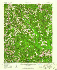
1957 · Jackson Springs
USGS Topo · 1:62,500

1974 · Candor
USGS Topo · 1:24,000