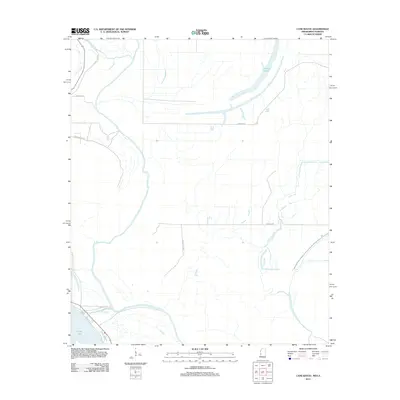
2012 Map of Cane Bayou
USGS Topo · Published 2012About this map
Eagle Lake dominates the southwestern corner of this delta landscape, where the shifting hydrology of the Mississippi-Louisiana border is clearly etched into the terrain. The presence of Muddy Bayou and Cypress Lake indicates a low-lying area defined by its watercourses and floodplains, characteristic of the region north of Vicksburg. This 2012 survey reveals a sparsely populated rural network of local roads that navigate around these significant water bodies. Notable thoroughfares such as Belle Island Dr, Muddy Bayou Rd, and Newman Rd connect isolated homesteads and recreational properties. The map serves as a detailed record of the drainage patterns and land use in this specific riverine environment, providing essential data for those studying the evolving geography of Warren County and the adjacent parishes across the state line.
Find a feature on this map
10 named features on this map. Tap any name to fly to it.
Don’t see what you’re looking for? This feature index may not catch every label — zoom into the map to look around manually.
Map Details
Editions of this 2012 Cane Bayou Map
This is the sole edition of this map. No revisions or reprints were ever made.
Other maps of this area

1909 · Millikens Bend
USGS Topo · 1:24,000

1918 · Vicksburg
USGS Topo · 1:62,500

1939 · Onward
USGS Topo · 1:62,500

1939 · Talla Bena
USGS Topo · 1:62,500

1939 · Alsatia
USGS Topo · 1:62,500

1941 · Vicksburg
USGS Topo · 1:62,500

1955 · Jackson
USGS Topo · 1:250,000

1961 · Jackson
USGS Topo · 1:250,000

1962 · Jackson
USGS Topo · 1:250,000

1962 · Redwood
USGS Topo · 1:24,000