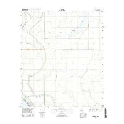
2015 Map of Cane Bayou
USGS Topo · Published 2015About this map
Steele Bayou meanders through this low-lying borderland where Warren and Issaquena counties meet. The landscape is defined by its complex hydrologic network, featuring the prominent Eagle Lake and smaller water bodies like Cypress Lake. A network of local rural routes, including Newman Rd and Summerall Rd, provides access to the interior sections, while the western edge is bounded by the Mississippi-Louisiana state line and the Madison Parish boundary.
Find a feature on this map
19 named features on this map. Tap any name to fly to it.
Don’t see what you’re looking for? This feature index may not catch every label — zoom into the map to look around manually.
Map Details
Editions of this 2015 Cane Bayou Map
This is the sole edition of this map. No revisions or reprints were ever made.
Other maps of this area

1909 · Millikens Bend
USGS Topo · 1:24,000

1918 · Vicksburg
USGS Topo · 1:62,500

1939 · Onward
USGS Topo · 1:62,500

1939 · Talla Bena
USGS Topo · 1:62,500

1939 · Alsatia
USGS Topo · 1:62,500

1941 · Vicksburg
USGS Topo · 1:62,500

1955 · Jackson
USGS Topo · 1:250,000

1961 · Jackson
USGS Topo · 1:250,000

1962 · Jackson
USGS Topo · 1:250,000

1962 · Redwood
USGS Topo · 1:24,000