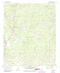
1964 Map of Cane Creek
USGS Topo · Published 1984About this map
Cane Creek and the surrounding woodlands of northern Grant County are defined by an intricate network of waterways draining toward the Saline River valley. This 1964 survey, with updates from the early 1980s, reveals a rural landscape where small communities like Bradley and Orion are connected by a web of backroads and the Railroad Trail. Local landmarks such as Tenmile Hill rise above the numerous creek branches, including Hurricane Creek and Maylow Creek. The settlement pattern is anchored by local spiritual and memorial sites, including Marlow Ch, Bethel Ch, and the Gum Springs Cem. Human impact on the land is visible through a prominent Pipeline, several Gravel Pits, and the private Flying W Ranch Landing Strip, illustrating a mix of traditional agriculture and modern infrastructure in mid-century Arkansas.
Find a feature on this map
41 named features on this map. Tap any name to fly to it.
Don’t see what you’re looking for? This feature index may not catch every label — zoom into the map to look around manually.
Map Details
Editions of this 1964 Cane Creek Map
4 editions found

Other maps of this area

1891 · Little Rock
USGS Topo · 1:125,000

1893 · Little Rock
USGS Topo · 1:125,000

1932 · Pastoria
USGS Topo · 1:62,500

1935 · Alexander
USGS Topo · 1:48,000

1935 · Pastoria
USGS Topo · 1:62,500

1940 · Woodson
USGS Topo · 1:31,680

1941 · Alexander
USGS Topo · 1:62,500

1944 · Spring Lake
USGS Topo · 1:31,680

1944 · Bryant
USGS Topo · 1:31,680
1954 · Woodson
USGS Topo · 1:24,000