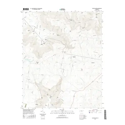
2016 Map of Cane Hollow
USGS Topo · Published 2016About this map
Altamont and the high reaches of the Cumberland Plateau anchor this 2016 survey along the border of Coffee and Grundy counties. The landscape is defined by the Tennessee Valley Divide, where water flows either toward the Elk River or into the deep incision of the Hickory Creek Gulf. This drainage pattern created a series of isolated coves and hollows, such as Northcutts Cove and Burrow Cove, which dictated the early settlement patterns of the region. Family history is etched into the terrain through numerous small burial grounds including Airview Cem, Johnny Cem, and Winton Cem. At lower elevations, the village of Pelham sits near the confluence of Mill Creek and Elk River, while the Piney Creek Airport provides a modern navigational landmark on the plateau. The map details an intricate network of local routes like Old Hickory Creek Road and Cabbage Patch Road that follow the natural contours of the plateau and its surrounding coves.
Find a feature on this map
90 named features on this map. Tap any name to fly to it.
Don’t see what you’re looking for? This feature index may not catch every label — zoom into the map to look around manually.
Map Details
Editions of this 2016 Cane Hollow Map
This is the sole edition of this map. No revisions or reprints were ever made.
Other maps of this area

1893 · Mc Minnville
USGS Topo · 1:125,000

1895 · Mc Minnville
USGS Topo · 1:125,000

1895 · Sewanee
USGS Topo · 1:125,000

1936 · Alto
USGS Topo · 1:24,000

1936 · Burrow Cove
USGS Topo · 1:24,000

1936 · Tracy City
USGS Topo · 1:24,000

1936 · Morrison
USGS Topo · 1:24,000

1936 · Hillsboro
USGS Topo · 1:24,000

1936 · Cane Hollow
USGS Topo · 1:24,000

1943 · Mc Minnville
USGS Topo · 1:100,000