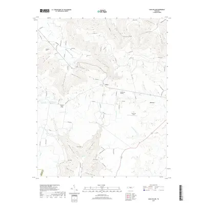
2019 Map of Cane Hollow
USGS Topo · Published 2019About this map
Altamont and the small settlement of Hixon anchor this survey of the Cumberland Plateau, where the complex drainage of the Elk River and Hickory Creek carves deep into the Tennessee landscape. The terrain is defined by dramatic escarpments and hollows, including the steep Hickory Creek Gulf and Millstone Hollow. Local family history is preserved through several small burial grounds such as Airview Cemetery, Winton Cemetery, and Wooten Cemetery, which are scattered among the ridges.
Find a feature on this map
92 named features on this map. Tap any name to fly to it.
Don’t see what you’re looking for? This feature index may not catch every label — zoom into the map to look around manually.
Map Details
Editions of this 2019 Cane Hollow Map
This is the sole edition of this map. No revisions or reprints were ever made.
Other maps of this area

1893 · Mc Minnville
USGS Topo · 1:125,000

1895 · Mc Minnville
USGS Topo · 1:125,000

1895 · Sewanee
USGS Topo · 1:125,000

1936 · Alto
USGS Topo · 1:24,000

1936 · Burrow Cove
USGS Topo · 1:24,000

1936 · Tracy City
USGS Topo · 1:24,000

1936 · Morrison
USGS Topo · 1:24,000

1936 · Hillsboro
USGS Topo · 1:24,000

1936 · Cane Hollow
USGS Topo · 1:24,000

1943 · Mc Minnville
USGS Topo · 1:100,000