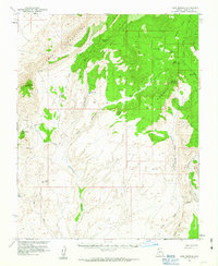
1954 Map of Cane Springs
USGS Topo · Published 1963About this map
Black Rock Mountain and the Virgin Mountains dominate this high-desert terrain in Mohave County, where the Arizona Strip meets the Great Basin. This 1950s survey, published with cooperation from the Atomic Energy Commission, documents a landscape of essential water sources and specialized extraction. Reliable water points like Jacobs Well, Cottonwood Spring, and Cane Springs are critical landmarks across the arid topography. Industrial activity is noted at the Lime Kiln Mine and several other prospects, while the dramatic Grand Wash Cliffs drop away toward the south. The mapping of Twists Road and various jeep trails indicates the remote network required to reach these high peaks and deep canyons, including Jump Canyon and Hidden Canyon, before modern infrastructure transformed access to the region.
Find a feature on this map
30 named features on this map. Tap any name to fly to it.
Don’t see what you’re looking for? This feature index may not catch every label — zoom into the map to look around manually.
Map Details
Editions of this 1954 Cane Springs Map
3 editions found

Other maps of this area

1886 · Saint Thomas
USGS Topo · 1:250,000

1886 · Mt. Trumbull
USGS Topo · 1:250,000

1892 · Mt. Trumbull
USGS Topo · 1:250,000

1893 · Saint Thomas
USGS Topo · 1:250,000

1926 · Bonelli
USGS Topo · 1:96,000

1953 · Gold Butte
USGS Topo · 1:62,500

1953 · Grand Canyon
USGS Topo · 1:250,000

1954 · Las Vegas
USGS Topo · 1:250,000

1954 · Littlefield 3 SW
USGS Topo · 1:24,000

1954 · Littlefield 3 NE
USGS Topo · 1:24,000