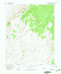
1954 Map of Cane Springs
USGS Topo · Published 1983About this map
Cane Springs and several other vital water sources define this arid landscape in the mid-1950s, serving as focal points for human activity and livestock in the Arizona desert. The map captures the industrial and ranching infrastructure of Mohave County, where the Lime Kiln Mine and several prospects suggest mineral exploration near the Virgin Mountains. A network of water points like Cottonwood Spring, Sand Spring, and Jacobs Well are connected by a scattered system of jeep trails, which navigate the complex drainage patterns of Cull and Tom Wash and Grand Wash.
Find a feature on this map
33 named features on this map. Tap any name to fly to it.
Don’t see what you’re looking for? This feature index may not catch every label — zoom into the map to look around manually.
Map Details
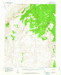
Editions of this 1954 Cane Springs Map
3 editions found

Other maps of this area

1886 · Saint Thomas
USGS Topo · 1:250,000

1886 · Mt. Trumbull
USGS Topo · 1:250,000

1892 · Mt. Trumbull
USGS Topo · 1:250,000

1893 · Saint Thomas
USGS Topo · 1:250,000

1926 · Bonelli
USGS Topo · 1:96,000

1953 · Gold Butte
USGS Topo · 1:62,500

1953 · Grand Canyon
USGS Topo · 1:250,000

1954 · Las Vegas
USGS Topo · 1:250,000

1954 · Littlefield 3 SW
USGS Topo · 1:24,000

1954 · Littlefield 3 NE
USGS Topo · 1:24,000