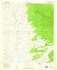
1958 Map of Canelo Pass
USGS Topo · Published 1959About this map
San Rafael Del La Zanja Grant Boundary divides the high desert plains from the elevations of the Coronado National Forest in this late 1950s survey of southern Arizona. The landscape is defined by the headwaters of the Santa Cruz River and a network of remote cattle operations, including the Little Outfit Ranch and Vaca Ranch. Water management is central to life here, evidenced by numerous named stock tanks such as Bog Hole Tank and Rosemary Tank scattered across the Meadow Valley Flat and the slopes of the Canelo Hills.
Find a feature on this map
43 named features on this map. Tap any name to fly to it.
Don’t see what you’re looking for? This feature index may not catch every label — zoom into the map to look around manually.
Map Details
Editions of this 1958 Canelo Pass Map
Other maps of this area

1904 · Patagonia
USGS Topo · 1:125,000

1905 · Patagonia
USGS Topo · 1:125,000

1905 · Nogales
USGS Topo · 1:125,000

1914 · Hereford
USGS Topo · 1:125,000

1915 · Benson
USGS Topo · 1:125,000

1922 · Sunnyside
USGS Topo · 1:62,500

1932 · Lochiel
USGS Topo · 1:62,500

1932 · Elgin
USGS Topo · 1:62,500

1938 · Huachuca
USGS Topo · 1:62,500

1938 · Sunnyside
USGS Topo · 1:62,500