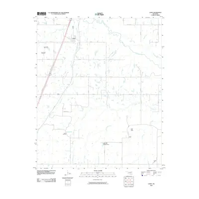
2009 Map of Caney
USGS Topo · Published 2009About this map
Caney anchors the northern reaches of this landscape, where the confluence of several major waterways defines the local geography. The winding path of Clear Boggy Creek moves across the northeast, while the drainage of Caney Creek and Davis Creek shapes the western and central corridors. Water management is a visible priority here, evidenced by engineered structures like the Caney Creek Site 1 Dam, Caney Creek Site 2 Dam, and the Lower Clear Boggy Site Number 38 Dam which regulates flows near the southern boundary.
Find a feature on this map
38 named features on this map. Tap any name to fly to it.
Don’t see what you’re looking for? This feature index may not catch every label — zoom into the map to look around manually.
Map Details
Editions of this 2009 Caney Map
This is the sole edition of this map. No revisions or reprints were ever made.
Other maps of this area

1899 · Atoka
USGS Topo · 1:125,000

1900 · Atoka
USGS Topo · 1:125,000

1957 · Bruno
USGS Topo · 1:24,000

1957 · Ardmore
USGS Topo · 1:250,000

1963 · Ardmore
USGS Topo · 1:250,000
1969 · Boggy Depot
USGS Topo · 1:24,000

1969 · Caddo North
USGS Topo · 1:24,000

1969 · Bokchito
USGS Topo · 1:24,000
1969 · Caddo South
USGS Topo · 1:24,000
1969 · Tushka
USGS Topo · 1:24,000