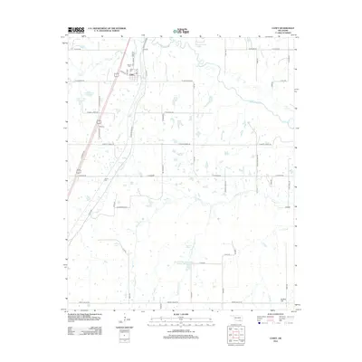
2012 Map of Caney
USGS Topo · Published 2012About this map
Caney serves as the primary hub in this corner of Atoka County, situated at the junction of W Main St and the rail line. The landscape is defined by its sophisticated water management systems, including the Caney Cr Site 1 Reservoir and the Lower Clear Boggy Site Number 38 Reservoir. Genealogists will find significant value in the mapped locations of Stewart Cem, Caney Cem, and Folsom Cem, which anchor the local family histories of the area.
Find a feature on this map
63 named features on this map. Tap any name to fly to it.
Don’t see what you’re looking for? This feature index may not catch every label — zoom into the map to look around manually.
Map Details
Editions of this 2012 Caney Map
This is the sole edition of this map. No revisions or reprints were ever made.
Other maps of this area

1899 · Atoka
USGS Topo · 1:125,000

1900 · Atoka
USGS Topo · 1:125,000

1957 · Bruno
USGS Topo · 1:24,000

1957 · Ardmore
USGS Topo · 1:250,000

1963 · Ardmore
USGS Topo · 1:250,000
1969 · Boggy Depot
USGS Topo · 1:24,000

1969 · Caddo North
USGS Topo · 1:24,000

1969 · Bokchito
USGS Topo · 1:24,000
1969 · Caddo South
USGS Topo · 1:24,000
1969 · Tushka
USGS Topo · 1:24,000