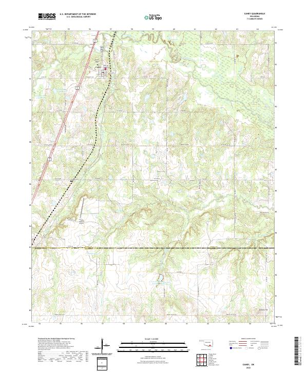
2022 Map of Caney
USGS Topo · Published 2022About this map
Caney serves as the primary settlement in this corner of Oklahoma, situated just north of the Atoka County and Bryan County boundary. The landscape is defined by its complex hydrology, with the winding course of Clear Boggy Creek and Caney Creek feeding into several engineered water management structures, including Lower Clear Boggy Site Number 38 Reservoir and Caney Creek Site 1 Reservoir. These reservoirs suggest a managed agricultural landscape where water control is essential to local land use.
Find a feature on this map
44 named features on this map. Tap any name to fly to it.
Don’t see what you’re looking for? This feature index may not catch every label — zoom into the map to look around manually.
Map Details
Editions of this 2022 Caney Map
This is the sole edition of this map. No revisions or reprints were ever made.
Other maps of this area

1899 · Atoka
USGS Topo · 1:125,000

1900 · Atoka
USGS Topo · 1:125,000

1957 · Bruno
USGS Topo · 1:24,000

1957 · Ardmore
USGS Topo · 1:250,000

1963 · Ardmore
USGS Topo · 1:250,000
1969 · Boggy Depot
USGS Topo · 1:24,000

1969 · Caddo North
USGS Topo · 1:24,000

1969 · Bokchito
USGS Topo · 1:24,000
1969 · Caddo South
USGS Topo · 1:24,000
1969 · Tushka
USGS Topo · 1:24,000