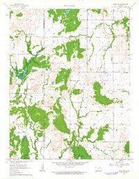
1962 Map of Caney NW
USGS Topo · Published 1963About this map
Salt Creek, Rutland, and Washington townships anchor this 1960s landscape along the border of Montgomery and Chautauqua counties. The terrain is defined by a dense network of timbered ridges and winding watercourses, including Bee Creek, Illinois Creek, and Card Creek. At this time, rural life was centered around local landmarks such as the Community Hall, Lone Cherry Ch, and Sunny Side Sch. Genealogists will find particular value in the clearly marked burial grounds, including Burton Cem, Rutland Cem, and Todd Cem. The creation of Bee Creek Lake and the presence of a Gaging Station reflect mid-century water management efforts. This survey captures the transition between the rolling uplands of Berry Hill and the fertile creek bottoms before modern agricultural consolidation further changed the settlement pattern.
Find a feature on this map
22 named features on this map. Tap any name to fly to it.
Don’t see what you’re looking for? This feature index may not catch every label — zoom into the map to look around manually.
Map Details
Editions of this 1962 Caney NW Map
This is the sole edition of this map. No revisions or reprints were ever made.
Other maps of this area

1885 · Sedan
USGS Topo · 1:125,000

1886 · Independence
USGS Topo · 1:125,000

1889 · Sedan
USGS Topo · 1:125,000

1894 · Independence
USGS Topo · 1:125,000

1905 · Independence
USGS Topo · 1:125,000

1947 · Joplin
USGS Topo · 1:250,000

1949 · Joplin
USGS Topo · 1:250,000

1954 · Joplin
USGS Topo · 1:250,000

1955 · Wichita
USGS Topo · 1:250,000

1958 · Wichita
USGS Topo · 1:250,000