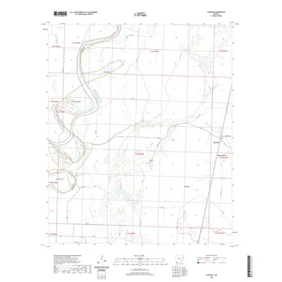
2020 Map of Canfield
USGS Topo · Published 2020About this map
The Red River defines the western landscape of this Arkansas-Louisiana borderlands region, carving dramatic oxbows and curves like Dillard Bend and Dickson Bend. This intricate fluvial environment is characterized by a network of sluggish waterways including Maniece Bayou, Field Bayou, and Posten Bayou, which drain the low-lying bottomlands between the river and the higher ground to the east. The settlement of Canfield sits near the eastern edge of the quadrangle, serving as a local hub near Burton Mill and the Union Hill Cemetery.
Find a feature on this map
44 named features on this map. Tap any name to fly to it.
Don’t see what you’re looking for? This feature index may not catch every label — zoom into the map to look around manually.
Map Details
Editions of this 2020 Canfield Map
This is the sole edition of this map. No revisions or reprints were ever made.
Other maps of this area

1952 · Doddridge SE
USGS Topo · 1:24,000

1952 · Bradley
USGS Topo · 1:24,000

1952 · Garland
USGS Topo · 1:24,000

1952 · Fouke SE
USGS Topo · 1:24,000

1952 · Bradley NE
USGS Topo · 1:24,000

1952 · Doddridge NE
USGS Topo · 1:24,000

1952 · Canfield
USGS Topo · 1:24,000

1952 · Lewisville
USGS Topo · 1:24,000

1952 · Bradley SE
USGS Topo · 1:24,000

1953 · El Dorado
USGS Topo · 1:250,000