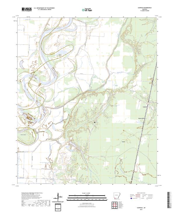
2024 Map of Canfield
USGS Topo · Published 2024About this map
The Red River carves a winding path through this corner of Southwest Arkansas, creating dramatic oxbow features like Dillard Bend and Dickson Bend. The landscape is defined by its complex hydrology, where Maniece Bayou, Field Bayou, and Posten Bayou thread through the lowlands alongside bodies of water such as Upper Jew Jon Lake and Bradley Lake. This network of waterways historically dictated the settlement patterns of the region, visible here in the placement of small communities and rural infrastructure.
Find a feature on this map
44 named features on this map. Tap any name to fly to it.
Don’t see what you’re looking for? This feature index may not catch every label — zoom into the map to look around manually.
Map Details
Editions of this 2024 Canfield Map
This is the sole edition of this map. No revisions or reprints were ever made.
Other maps of this area

1952 · Doddridge SE
USGS Topo · 1:24,000

1952 · Bradley
USGS Topo · 1:24,000

1952 · Garland
USGS Topo · 1:24,000

1952 · Fouke SE
USGS Topo · 1:24,000

1952 · Bradley NE
USGS Topo · 1:24,000

1952 · Doddridge NE
USGS Topo · 1:24,000

1952 · Canfield
USGS Topo · 1:24,000

1952 · Lewisville
USGS Topo · 1:24,000

1952 · Bradley SE
USGS Topo · 1:24,000

1953 · El Dorado
USGS Topo · 1:250,000