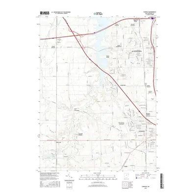
2016 Map of Canfield
USGS Topo · Published 2016About this map
Austintown and Canfield anchor this portion of Mahoning County, where the sprawling waters of the Meander Cr Reservoir dominate the northern landscape. The terrain transitions from the elevations of Mineral Ridge and Stony Ridge in the north toward the smaller water bodies of Palmyra Lake, Upper Diehl Lake, and Lower Diehl Lake to the south. This area is notably rich in genealogical sites, featuring numerous small burial grounds such as the Cotton Private Cem, Brunsteter Cem, and the Covenanter Cem near Geeburg. The Ohio Tpke cuts diagonally across the center, linking the larger townships to outlying communities like North Jackson and Ellsworth. Educational and community hubs are well-defined, including the Mahoning County Joint Vocational School and various local landmarks like Brocker Field near Smith Corners.
Find a feature on this map
169 named features on this map. Tap any name to fly to it.
Don’t see what you’re looking for? This feature index may not catch every label — zoom into the map to look around manually.
Map Details
Editions of this 2016 Canfield Map
This is the sole edition of this map. No revisions or reprints were ever made.
Other maps of this area

1906 · Youngstown
USGS Topo · 1:62,500

1907 · Columbiana
USGS Topo · 1:62,500

1908 · Youngstown
USGS Topo · 1:62,500

1908 · Warren
USGS Topo · 1:62,500

1909 · Lisbon
USGS Topo · 1:62,500

1909 · Columbiana
USGS Topo · 1:62,500

1950 · Cleveland
USGS Topo · 1:250,000

1951 · Canton
USGS Topo · 1:250,000

1951 · Columbiana
USGS Topo · 1:24,000

1951 · Youngstown
USGS Topo · 1:24,000