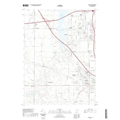
2019 Map of Canfield
USGS Topo · Published 2019About this map
Canfield and West Austintown serve as the primary hubs in this modern topographic record of Mahoning County. The landscape is defined by the significant reach of the Meander Creek Reservoir, which stretches through the northern half of the quadrangle, flanked by established settlements such as North Jackson and Smith Corners. A dense network of roads, including the Akron Canfield Rd and Mahoning Ave, connects numerous rural communities like Geeburg, Ellsworth, and Dublin.
Find a feature on this map
166 named features on this map. Tap any name to fly to it.
Don’t see what you’re looking for? This feature index may not catch every label — zoom into the map to look around manually.
Map Details
Editions of this 2019 Canfield Map
This is the sole edition of this map. No revisions or reprints were ever made.
Other maps of this area

1906 · Youngstown
USGS Topo · 1:62,500

1907 · Columbiana
USGS Topo · 1:62,500

1908 · Youngstown
USGS Topo · 1:62,500

1908 · Warren
USGS Topo · 1:62,500

1909 · Lisbon
USGS Topo · 1:62,500

1909 · Columbiana
USGS Topo · 1:62,500

1950 · Cleveland
USGS Topo · 1:250,000

1951 · Canton
USGS Topo · 1:250,000

1951 · Columbiana
USGS Topo · 1:24,000

1951 · Youngstown
USGS Topo · 1:24,000