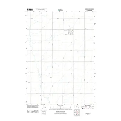
2012 Map of Canistota
USGS Topo · Published 2012About this map
The W Fork Vermillion River meanders through this McCook County landscape, defining the agricultural character of the region. The map centers on the community of Canistota, where a grid of residential and commercial streets such as W Willow St, W Ash St, and Railroad St E cluster near the local Po. Aviation and infrastructure are represented by the Ortman Landing Strip, which sits just northwest of the town center.
Find a feature on this map
27 named features on this map. Tap any name to fly to it.
Don’t see what you’re looking for? This feature index may not catch every label — zoom into the map to look around manually.
Map Details
Editions of this 2012 Canistota Map
This is the sole edition of this map. No revisions or reprints were ever made.
Other maps of this area

1898 · Parker
USGS Topo · 1:125,000

1955 · Sioux Falls
USGS Topo · 1:250,000

1958 · Sioux Falls
USGS Topo · 1:250,000

1964 · Montrose
USGS Topo · 1:24,000

1964 · Canistota
USGS Topo · 1:24,000

1964 · Salem NE
USGS Topo · 1:24,000

1964 · Salem
USGS Topo · 1:24,000

1964 · Bridgewater East
USGS Topo · 1:24,000

1964 · East Vermillion Lake
USGS Topo · 1:24,000
1968 · Parker
USGS Topo · 1:24,000