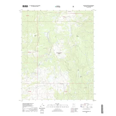
2020 Map of Canjilon Mountain
USGS Topo · Published 2020About this map
Canjilon Mountain dominates this portion of the Carson National Forest, where a high-elevation drainage system feeds a series of alpine water bodies. The terrain is defined by a dense network of canyons and meadows, including Canjilon Meadows and the sprawling Gurule Canyon to the southeast. A significant corridor for backcountry travel is established by the Continental Divide National Scenic Trail, which winds past heights like Mogote Ridge and provides access to the clustered Upper Canjilon Lakes, Middle Canjilon Lakes, and Lower Canjilon Lakes. Numerous named springs and tanks, such as Fifteen Springs and Patito Tank, indicate the vital water sources supporting this high-country landscape. This 2020 survey captures the modern forest road system, including Co Rd 280 and FDR 274, which navigate the complex topography of ridges and cañadas.
Find a feature on this map
48 named features on this map. Tap any name to fly to it.
Don’t see what you’re looking for? This feature index may not catch every label — zoom into the map to look around manually.
Map Details
Editions of this 2020 Canjilon Mountain Map
This is the sole edition of this map. No revisions or reprints were ever made.
Other maps of this area

1918 · Abiquiu
USGS Topo · 1:125,000

1918 · Tusas
USGS Topo · 1:125,000

1953 · Valle Grande Peak
USGS Topo · 1:24,000

1953 · Magote Peak
USGS Topo · 1:24,000

1953 · Canjilon
USGS Topo · 1:24,000

1954 · Aztec
USGS Topo · 1:250,000

1955 · Cebolla
USGS Topo · 1:62,500

1958 · Aztec
USGS Topo · 1:250,000

1962 · Aztec
USGS Topo · 1:250,000

1963 · Burned Mountain
USGS Topo · 1:24,000