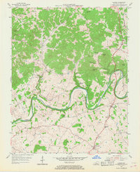
1953 Map of Canmer
USGS Topo · Published 1968About this map
The Green River meanders in tight, dramatic oxbows across this Hart County landscape, creating prominent landforms like Horseshoe Bend, Rio Bend, and Sims Bend. The river’s path defines the settlement patterns and agriculture of the early 1950s, with small communities such as Canmer and Hardyville situated along the primary transit corridor of the Jackson Highway.
Find a feature on this map
36 named features on this map. Tap any name to fly to it.
Don’t see what you’re looking for? This feature index may not catch every label — zoom into the map to look around manually.
Map Details
Editions of this 1953 Canmer Map
4 editions found
Other maps of this area

1934 · Munfordville
USGS Topo · 1:48,000

1935 · Horse Cave
USGS Topo · 1:48,000

1937 · Munfordville
USGS Topo · 1:62,500

1938 · Horse Cave
USGS Topo · 1:62,500

1953 · Hudgins
USGS Topo · 1:24,000

1953 · Munfordville
USGS Topo · 1:24,000

1953 · Magnolia
USGS Topo · 1:24,000

1953 · Center
USGS Topo · 1:24,000
1953 · Canmer
USGS Topo · 1:24,000

1954 · Park
USGS Topo · 1:24,000