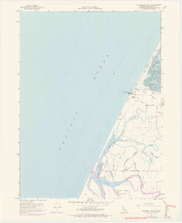
1959 Map of Cannibal Island
USGS Topo · Published 1974About this map
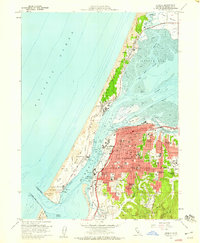
Cannibal Island and the surrounding marshlands dominate this 1950s coastal survey, revealing a landscape defined by an intricate network of sloughs and reclaimed agricultural land. Protective structures such as the extensive levee system along McNulty Slough and Hawk Slough illustrate the ongoing effort to manage the tidal influence of the Pacific Ocean and the Eel River. To the north, the Table Bluff Lighthouse Coast Guard Reservation stands atop the prominent Table Bluff, overlooking the South Spit that separates the open ocean from the calm waters of South Bay. Local infrastructure is concentrated along roads like Copenhagen Road and Cannibal Road, where the Eel River School served the rural community of Ocean Ranch. The mapping includes purple revisions from the early 1970s, showing changes to the Sand Dunes and shoreline before modern environmental shifts further altered this Humboldt County delta.
Find a feature on this map
29 named features on this map. Tap any name to fly to it.
Don’t see what you’re looking for? This feature index may not catch every label — zoom into the map to look around manually.
Map Details
Editions of this 1959 Cannibal Island Map
4 editions found
Other maps of this area

1916 · Cape Fortunas
USGS Topo · 1:62,500

1922 · Eureka
USGS Topo · 1:62,500

1933 · Eureka
USGS Topo · 1:48,000

1942 · Eureka
USGS Topo · 1:62,500

1943 · Ferndale
USGS Topo · 1:62,500

1944 · Fortuna
USGS Topo · 1:62,500

1949 · Eureka
USGS Topo · 1:250,000

1951 · Eureka
USGS Topo · 1:62,500

1951 · Ferndale
USGS Topo · 1:62,500
1958 · Eureka
USGS Topo · 1:24,000