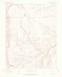
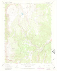
1963 Map of Cannibal Plateau
USGS Topo · Published 1972About this map
Gunnison National Forest dominates this high-altitude landscape in Hinsdale County, where dramatic topographic shifts are evidenced by the massive Slumgullion Slide at the southern edge of the sheet. The high-country terrain is defined by the broad Cannibal Plateau and Mesa Seco, separated by deep drainage systems like Devils Canyon. The 1963 field check reveals a network of primitive transportation and water sources, including the Pack Trail winding through the wilderness and isolated points like Infierno Spring. Water features such as Devils Lake and the Deer Lakes provide focal points for the high basin, while Middle Fork Powderhorn Creek and its tributaries carve the north-facing slopes. This era of the landscape is caught just as recreational use began to leave more permanent marks, such as the Hidden Valley Campground near the forest boundary.
Find a feature on this map
26 named features on this map. Tap any name to fly to it.
Don’t see what you’re looking for? This feature index may not catch every label — zoom into the map to look around manually.
Map Details
Editions of this 1963 Cannibal Plateau Map
5 editions found
Other maps of this area

1903 · Lake City
USGS Topo · 1:62,500

1905 · Lake City
USGS Topo · 1:62,500

1905 · San Cristobal
USGS Topo · 1:125,000

1907 · San Cristobal
USGS Topo · 1:125,000

1908 · Uncompahgre
USGS Topo · 1:125,000

1911 · Uncompahgre
USGS Topo · 1:125,000

1945 · Durango
USGS Topo · 1:250,000

1953 · Durango
USGS Topo · 1:250,000

1954 · Durango
USGS Topo · 1:250,000

1956 · Montrose
USGS Topo · 1:250,000