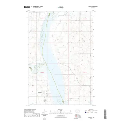
2017 Map of Cannon Ball
USGS Topo · Published 2017About this map
Cannon Ball sits at the confluence of the Missouri River and the Cannonball River, a site defined by the vast waters of Lake Oahe. The landscape reflects the rural social structure of the Standing Rock Reservation area, anchored by the Saint Elizabeth's Catholic Cem and the Cannon Ball Memorial Congregational Cem. To the north, the presence of Badger School near Badger Creek suggests a once-active rural education node serving the surrounding ranchland. The terrain is marked by distinctive elevations such as Coal Butte and Twin Buttes, which rise above the river valley. The road network, including White Owl St and Weasel St, provides localized access to the residential core of the settlement, while the surrounding hills remain relatively undeveloped, preserving the character of the Missouri River breaks.
Find a feature on this map
28 named features on this map. Tap any name to fly to it.
Don’t see what you’re looking for? This feature index may not catch every label — zoom into the map to look around manually.
Map Details
Editions of this 2017 Cannon Ball Map
This is the sole edition of this map. No revisions or reprints were ever made.
Other maps of this area

1907 · Bismarck
USGS Topo · 1:125,000

1954 · Bismarck
USGS Topo · 1:250,000

1958 · Bismarck
USGS Topo · 1:250,000

1968 · Cannon Ball
USGS Topo · 1:24,000

1968 · Cannon Ball SE
USGS Topo · 1:24,000

1968 · Cannon Ball NW
USGS Topo · 1:24,000

1968 · Cannon Ball SW
USGS Topo · 1:24,000

1971 · Moffit SW
USGS Topo · 1:24,000

1971 · Huff
USGS Topo · 1:24,000

1971 · Fort Rice
USGS Topo · 1:24,000