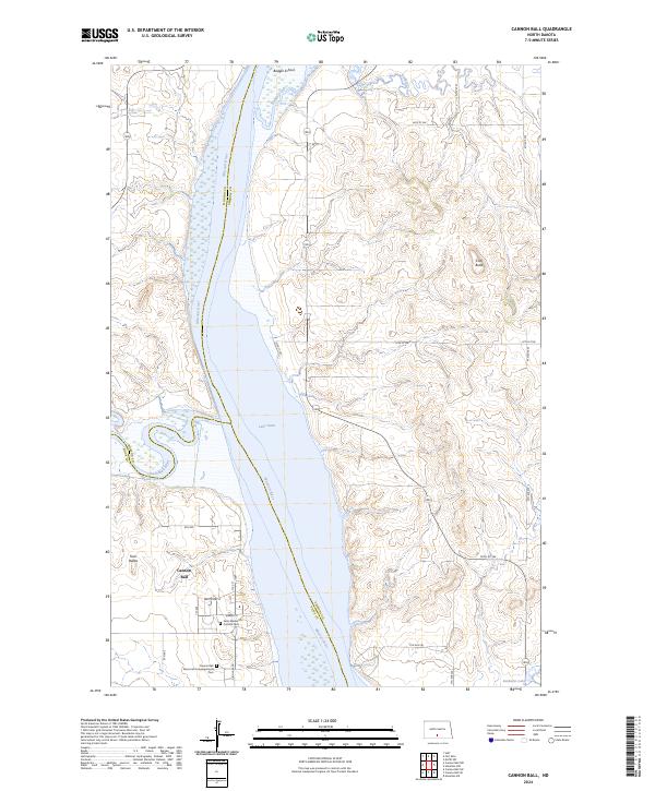
2024 Map of Cannon Ball
USGS Topo · Published 2024About this map
The confluence of the Missouri River and the Cannonball River defines this riverine landscape south of the Morton and Emmons county line. In the settlement of Cannon Ball, the local street grid including White Owl St and Weasel St reflects the community's layout near significant religious and burial sites. Local genealogy and history are anchored by Saint Elizabeth's Catholic Cem and the Cannon Ball Memorial Congregational Cem, while the northern portion of the map is marked by the rural Badger School near the banks of Badger Creek. The vast expanse of Lake Oahe dominates the river valley, flanked by terrain features like Twin Buttes and Coal Butte. To the southeast, the Emmons County Waterfowl Production Area and Sunburst Lake highlight the managed conservation lands of the Missouri River corridor.
Find a feature on this map
32 named features on this map. Tap any name to fly to it.
Don’t see what you’re looking for? This feature index may not catch every label — zoom into the map to look around manually.
Map Details
Editions of this 2024 Cannon Ball Map
This is the sole edition of this map. No revisions or reprints were ever made.
Other maps of this area

1907 · Bismarck
USGS Topo · 1:125,000

1954 · Bismarck
USGS Topo · 1:250,000

1958 · Bismarck
USGS Topo · 1:250,000

1968 · Cannon Ball
USGS Topo · 1:24,000

1968 · Cannon Ball SE
USGS Topo · 1:24,000

1968 · Cannon Ball NW
USGS Topo · 1:24,000

1968 · Cannon Ball SW
USGS Topo · 1:24,000

1971 · Moffit SW
USGS Topo · 1:24,000

1971 · Huff
USGS Topo · 1:24,000

1971 · Fort Rice
USGS Topo · 1:24,000