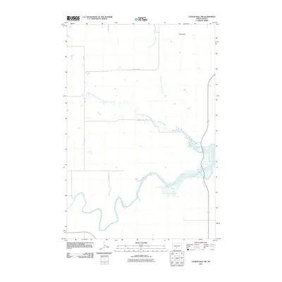
2011 Map of Cannon Ball NW
USGS Topo · Published 2011About this map
The Cannonball River meanders across this rural Sioux County landscape, defining the southern topography with its dramatic oxbows and riparian wetlands. To the north, the terrain is shaped by the drainage network of Cantapeta Creek, including its North Branch and Northwest Branch. These waterways carve through the prairie, leading toward the distinct landmark of Castle Butte in the northeast. This 2011 survey illustrates a sparse, agricultural infrastructure where the section line grid is maintained by unpaved local routes like 13th Ave and 14th Ave. Larger regional connectors such as County Rd-80 and County Rd-134 provide the primary east-west passage through this remote stretch of the North Dakota plains, reflecting a landscape still deeply tied to its natural watercourses and traditional land divisions.
Find a feature on this map
9 named features on this map. Tap any name to fly to it.
Don’t see what you’re looking for? This feature index may not catch every label — zoom into the map to look around manually.
Map Details
Editions of this 2011 Cannon Ball NW Map
This is the sole edition of this map. No revisions or reprints were ever made.
Other maps of this area

1907 · Bismarck
USGS Topo · 1:125,000

1954 · Bismarck
USGS Topo · 1:250,000

1958 · Bismarck
USGS Topo · 1:250,000

1968 · Cannon Ball
USGS Topo · 1:24,000

1968 · Cannon Ball SE
USGS Topo · 1:24,000

1968 · Cannon Ball NW
USGS Topo · 1:24,000

1968 · Cannon Ball SW
USGS Topo · 1:24,000

1971 · Half Timber Butte
USGS Topo · 1:24,000

1971 · Huff
USGS Topo · 1:24,000

1971 · Fort Rice
USGS Topo · 1:24,000