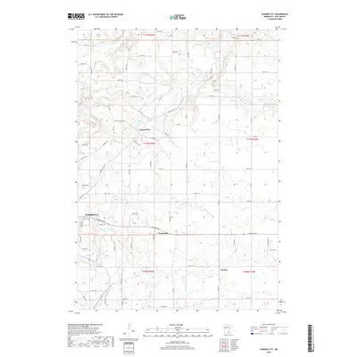
2019 Map of Cannon City
USGS Topo · Published 2019About this map
Cannon City sits at the heart of this Rice County landscape, illustrating a classic Midwestern pattern of small agricultural hamlets connected by a dense network of numbered range roads. The topography is defined by its diverse drainage systems, where the Cannon River and Straight River converge near the municipal boundaries of Faribault. This 2019 survey shows how the land is segmented by an orderly grid of local routes like Cannon City Blvd and Co Rd 20, which navigate the subtle rises between watercourses. To the east and south, the headwaters of the N Fork Zumbro River emerge, alongside the smaller communities of Prairieville and Ruskin. The map provides a precise look at the rural-urban interface as the residential edges of Faribault meet the sprawling farmlands of Cannon City and Walcott townships.
Find a feature on this map
70 named features on this map. Tap any name to fly to it.
Don’t see what you’re looking for? This feature index may not catch every label — zoom into the map to look around manually.
Map Details
Editions of this 2019 Cannon City Map
This is the sole edition of this map. No revisions or reprints were ever made.
Other maps of this area

1953 · Saint Paul
USGS Topo · 1:250,000

1959 · Saint Paul
USGS Topo · 1:250,000

1960 · Faribault
USGS Topo · 1:24,000

1960 · Northfield
USGS Topo · 1:24,000

1960 · Cannon City
USGS Topo · 1:24,000

1960 · Dennison
USGS Topo · 1:24,000

1960 · Little Chicago
USGS Topo · 1:24,000

1960 · Nerstrand
USGS Topo · 1:24,000

1962 · Medford East
USGS Topo · 1:24,000

1962 · Moland
USGS Topo · 1:24,000