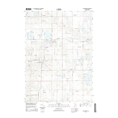
2014 Map of Cannonsburg
USGS Topo · Published 2014About this map
Bear Cr and Honey Cr carve through the glacial landscape of northeast Kent County, anchoring the historic communities of Cannonsburg and Parnell. This area is defined by its high density of kettle lakes and wetlands, ranging from the large recreational waters of Bostwick Lake and Murray Lake to smaller, secluded basins like Hyser Lake and Cowan Lake. The settlement pattern reflects a deeply rooted rural history, with numerous community burial grounds including Cannon Cem, Grattan Cem, and Marshall Cem serving as vital landmarks for genealogical research. A notable modern addition to this landscape is the N Country National Scenic Trail, which winds through the southern townships. The map illustrates a transition from the structured street grids of established hamlets to the winding lakeside drives and rural routes like Belding Rd NE that connect the region's scattered agricultural and residential pockets.
Find a feature on this map
82 named features on this map. Tap any name to fly to it.
Don’t see what you’re looking for? This feature index may not catch every label — zoom into the map to look around manually.
Map Details
Editions of this 2014 Cannonsburg Map
This is the sole edition of this map. No revisions or reprints were ever made.
Other maps of this area

1914 · Grand Rapids
USGS Topo · 1:62,500

1918 · Cedar Springs
USGS Topo · 1:62,500

1918 · Lowell
USGS Topo · 1:62,500

1943 · Cedar Springs
USGS Topo · 1:62,500

1943 · Grand Rapids
USGS Topo · 1:62,500

1943 · Lowell
USGS Topo · 1:62,500

1954 · Midland
USGS Topo · 1:250,000

1958 · Midland
USGS Topo · 1:250,000

1958 · Grand Rapids
USGS Topo · 1:250,000

1959 · Midland
USGS Topo · 1:250,000