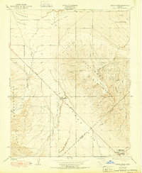
1950 Map of Canoas Creek
USGS Topo · Published 1950About this map
Kettleman Hills oil and gas activity defines this 1950 landscape along the border of Fresno and Kings Counties. The strategic Associated Oil Pumping Sta sits near the junction of the Coalinga and Bakersfield Road, serving as a vital industrial node within the North Dome oilfield. The terrain transitions from the alluvial fans of Pleasant Valley in the northwest to the intricate drainage systems of Canoas Creek and Garza Creek which carve through the Kreyenhagen Hills.
Find a feature on this map
27 named features on this map. Tap any name to fly to it.
Don’t see what you’re looking for? This feature index may not catch every label — zoom into the map to look around manually.
Map Details
Editions of this 1950 Canoas Creek Map
This is the sole edition of this map. No revisions or reprints were ever made.
Other maps of this area

1912 · Coalinga
USGS Topo · 1:125,000

1914 · Cholame
USGS Topo · 1:125,000

1915 · Cholame
USGS Topo · 1:125,000

1917 · Cholame
USGS Topo · 1:125,000

1930 · Discovery Well
USGS Topo · 1:31,680

1930 · Canoas Creek
USGS Topo · 1:31,680

1930 · Kettleman Plain
USGS Topo · 1:31,680

1933 · Huron
USGS Topo · 1:31,680

1933 · Guijarral Hills
USGS Topo · 1:31,680

1933 · Kettleman Plain
USGS Topo · 1:31,680