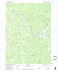
1982 Map of Cant Hook Mtn
USGS Topo · Published 1982About this map
The South Fork Smith River carves a deep path through this section of the Six Rivers National Forest in the early 1980s. The landscape is defined by its steep elevation changes, ranging from the depths of Haydens Gulch to the high points of Little Rattlesnake Mountain and Cant Hook Mtn. Human activity is concentrated along the riverbanks and ridges, evidenced by isolated outposts like Stevens Ranch and various resource extraction sites including the China Mine and several Borrow Pit locations.
Find a feature on this map
45 named features on this map. Tap any name to fly to it.
Don’t see what you’re looking for? This feature index may not catch every label — zoom into the map to look around manually.
Map Details
Editions of this 1982 Cant Hook Mtn Map
3 editions found
Other maps of this area

1922 · Preston Peak
USGS Topo · 1:125,000

1929 · Crescent City
USGS Topo · 1:125,000

1945 · Ship Mountain
USGS Topo · 1:62,500

1945 · Gasquet
USGS Topo · 1:62,500

1945 · Point St. George
USGS Topo · 1:62,500

1945 · Requa
USGS Topo · 1:62,500

1948 · Weed
USGS Topo · 1:250,000

1949 · Eureka
USGS Topo · 1:250,000

1950 · Weed
USGS Topo · 1:250,000

1951 · Gasquet
USGS Topo · 1:62,500