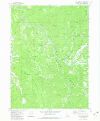
1982 Map of Cant Hook Mtn
USGS Topo · Published 1982About this map
The South Fork Smith River carves a deep path through this portion of the Six Rivers National Forest, shaping a landscape of steep ridges and isolated flats. This 1982 survey documents a region defined by remote resource extraction and forest management, where operations at the China Mine and several Mine and Prospect sites underscore the area's mineral interest. The river's winding course is punctuated by landmarks such as Hurdygurdy Bridge and Cable Crossing, facilitating access to the back country.
Find a feature on this map
46 named features on this map. Tap any name to fly to it.
Don’t see what you’re looking for? This feature index may not catch every label — zoom into the map to look around manually.
Map Details
Editions of this 1982 Cant Hook Mtn Map
3 editions found
Other maps of this area

1922 · Preston Peak
USGS Topo · 1:125,000

1929 · Crescent City
USGS Topo · 1:125,000

1945 · Ship Mountain
USGS Topo · 1:62,500

1945 · Gasquet
USGS Topo · 1:62,500

1945 · Point St. George
USGS Topo · 1:62,500

1945 · Requa
USGS Topo · 1:62,500

1948 · Weed
USGS Topo · 1:250,000

1949 · Eureka
USGS Topo · 1:250,000

1950 · Weed
USGS Topo · 1:250,000

1951 · Gasquet
USGS Topo · 1:62,500