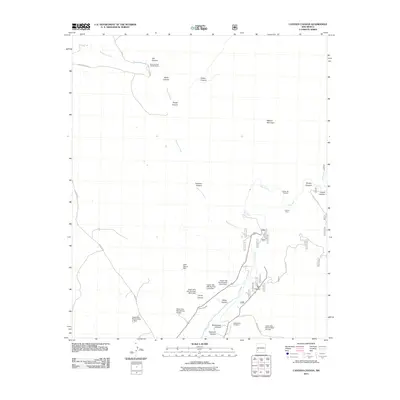
2011 Map of Canteen Canyon
USGS Topo · Published 2011About this map
Mogollon Creek and the Gila River converge in this high-desert landscape of Grant County, where water management and mining historically shaped the land. A series of flood control structures, including the Upper Gila Site Number Seven Dam and several neighboring dams, punctuate the canyons, while the Upper Gila Ditch reflects the area's agricultural reliance on irrigation. Local history is anchored by the Maldonado Cemetery and the Nine Hundred Sixteen Ranch in the north.
Find a feature on this map
32 named features on this map. Tap any name to fly to it.
Don’t see what you’re looking for? This feature index may not catch every label — zoom into the map to look around manually.
Map Details
Editions of this 2011 Canteen Canyon Map
This is the sole edition of this map. No revisions or reprints were ever made.
Other maps of this area

1909 · Silver City
USGS Topo · 1:125,000

1910 · Mogollon
USGS Topo · 1:125,000

1911 · Alum Mountain
USGS Topo · 1:125,000

1912 · Mogollon
USGS Topo · 1:125,000

1913 · Alum Mountain
USGS Topo · 1:125,000

1950 · Dorsey Ranch
USGS Topo · 1:24,000

1951 · Dorsey Ranch
USGS Topo · 1:24,000

1954 · Silver City
USGS Topo · 1:250,000

1954 · Clifton
USGS Topo · 1:250,000

1957 · Clifton
USGS Topo · 1:250,000