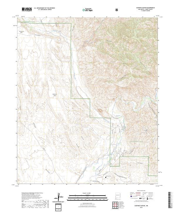
2023 Map of Canteen Canyon
USGS Topo · Published 2023About this map
Gila River drainage systems define the high-elevation landscape within this section of the Gila National Forest. The map shows a transition from the protected, roadless Gila Wilderness in the north to the more accessible canyon lands below. The presence of the Upper Gila Ditch indicates the historical importance of water management in this arid region, while the Maldonado Cem near Maldonado Canyon serves as a marker of the families who settled this territory. Major topographic landmarks like Watson Mtn and Mud Spring Mesa overlook a network of seasonal watercourses, including Mogollon Creek and Canteen Canyon. Forest access is maintained through routes such as Box Canyon Rd and Hooker Loop Rd, which trace the base of the steep canyon walls.
Find a feature on this map
36 named features on this map. Tap any name to fly to it.
Don’t see what you’re looking for? This feature index may not catch every label — zoom into the map to look around manually.
Map Details
Editions of this 2023 Canteen Canyon Map
This is the sole edition of this map. No revisions or reprints were ever made.
Other maps of this area

1909 · Silver City
USGS Topo · 1:125,000

1910 · Mogollon
USGS Topo · 1:125,000

1911 · Alum Mountain
USGS Topo · 1:125,000

1912 · Mogollon
USGS Topo · 1:125,000

1913 · Alum Mountain
USGS Topo · 1:125,000

1950 · Dorsey Ranch
USGS Topo · 1:24,000

1951 · Dorsey Ranch
USGS Topo · 1:24,000

1954 · Silver City
USGS Topo · 1:250,000

1954 · Clifton
USGS Topo · 1:250,000

1957 · Clifton
USGS Topo · 1:250,000