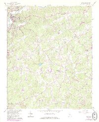
1961 Map of Canton
USGS Topo · Published 1986About this map
The Etowah River defines the northern reaches of this Cherokee County landscape, where the growing center of Canton is flanked by North Canton and South Canton. This mid-century record, updated with late 20th-century developments in purple, shows a transition from a river-and-rail economy toward suburban expansion. The Seaboard railroad line skirts the riverbank, passing by the local Hospital and the Waterworks. Away from the river, the terrain is dotted with small rural communities and historic gathering places such as Carmichael Crossroads, Hickory Flat, and Avery. Local genealogists will find several notable landmarks including River View Cem, Pugh Cem, and Shiloh Ch. The introduction of a Prison Camp, an Airstrip, and the Canton Country Club reflects the changing land use during this period of Georgia's development.
Find a feature on this map
47 named features on this map. Tap any name to fly to it.
Don’t see what you’re looking for? This feature index may not catch every label — zoom into the map to look around manually.
Map Details
Editions of this 1961 Canton Map
4 editions found
Other maps of this area

1890 · Suwanee
USGS Topo · 1:125,000

1890 · Cartersville
USGS Topo · 1:125,000

1891 · Cartersville
USGS Topo · 1:125,000

1894 · Suwanee
USGS Topo · 1:125,000

1896 · Cartersville
USGS Topo · 1:125,000

1907 · Acworth
USGS Topo · 1:62,500

1909 · Acworth
USGS Topo · 1:62,500

1926 · Tate
USGS Topo · 1:62,500

1928 · Tate
USGS Topo · 1:62,500

1947 · Waleska
USGS Topo · 1:62,500