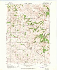
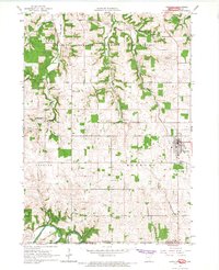
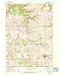
1965 Map of Canton
USGS Topo · Published 1966About this map
The Chicago Milwaukee St Paul and Pacific railroad cuts a diagonal path through this corner of Fillmore County, serving the established village of Canton. This mid-1960s survey captures a landscape defined by the winding waters of the South Fork Root River and its tributaries, including Wisel Creek and Sorenson Creek. Small rural communities and historically significant hamlets like Henrytown, Amherst, and Lenora are clearly mapped, providing a spatial record of settlement patterns in southeast Minnesota near the Iowa border. The terrain is notably dissected by these watercourses, creating deep valleys and high ridges that influenced the placement of early infrastructure. Genealogists will find the locations of several localized burial grounds, such as Scotland Cem, Henry Cem, and Elliota Cem, which remain as quiet landmarks of the region's pioneer families. Small-scale industrial activity is also noted through scattered quarries, particularly along the river bluffs near Amherst.
Find a feature on this map
28 named features on this map. Tap any name to fly to it.
Don’t see what you’re looking for? This feature index may not catch every label — zoom into the map to look around manually.
Map Details
Editions of this 1965 Canton Map
This is the sole edition of this map. No revisions or reprints were ever made.
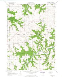
Other maps of this area

1906 · Decorah
USGS Topo · 1:125,000

1954 · Mason City
USGS Topo · 1:250,000

1957 · Mason City
USGS Topo · 1:250,000

1958 · Mason City
USGS Topo · 1:250,000

1958 · La Crosse
USGS Topo · 1:250,000

1961 · La Crosse
USGS Topo · 1:250,000

1965 · La Crosse
USGS Topo · 1:250,000
1965 · Harmony
USGS Topo · 1:24,000
1965 · Mabel
USGS Topo · 1:24,000
1965 · Bratsberg
USGS Topo · 1:24,000