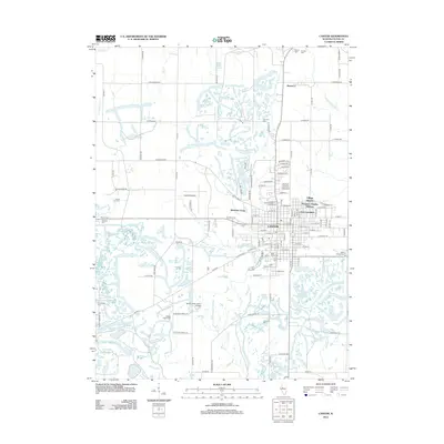
2012 Map of Canton
USGS Topo · Published 2012About this map
The city of Canton and its surrounding Fulton County landscape appear here in the early 2010s, characterized by a complex network of residential additions and a legacy of land use that has left numerous water bodies throughout the quadrangle. North of the city center, the community of Brereton sits near the headwaters of W Br Copperas Cr, while the urban core is flanked by distinct neighborhoods such as Village Square and Westview Acres. The presence of several large cemeteries, including Saint Marys Cem and Greenwood Cem, reflects the long-standing community history of the area.
Find a feature on this map
142 named features on this map. Tap any name to fly to it.
Don’t see what you’re looking for? This feature index may not catch every label — zoom into the map to look around manually.
Map Details
Editions of this 2012 Canton Map
This is the sole edition of this map. No revisions or reprints were ever made.
Other maps of this area

1912 · Canton
USGS Topo · 1:62,500

1925 · Havana
USGS Topo · 1:62,500

1929 · Manito
USGS Topo · 1:62,500

1930 · Glasford
USGS Topo · 1:62,500

1932 · Manito
USGS Topo · 1:62,500

1947 · Lewistown
USGS Topo · 1:24,000

1947 · St. David
USGS Topo · 1:24,000

1948 · Lewistown
USGS Topo · 1:24,000

1948 · St. David
USGS Topo · 1:24,000

1948 · Glasford
USGS Topo · 1:62,500