
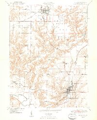
1948 Map of Lewistown
USGS Topo · Published 1948About this map
The Lewistown region of central Illinois is presented here as a landscape shaped by coal extraction and a dense network of rural infrastructure just after World War II. Large areas of Strip Mine operations dominate the northern sections near Cuba, indicating the heavy industrial influence on the local economy. In contrast, the southern portion of the quadrangle maintains its agrarian roots, defined by the winding course of the Spoon River and an extensive Levee system protecting the bottomlands.
Find a feature on this map
34 named features on this map. Tap any name to fly to it.
Don’t see what you’re looking for? This feature index may not catch every label — zoom into the map to look around manually.
Map Details
Editions of this 1948 Lewistown Map
2 editions found
Other maps of this area

1912 · Canton
USGS Topo · 1:62,500

1915 · Avon
USGS Topo · 1:62,500

1918 · Vermont
USGS Topo · 1:62,500

1921 · Vermont
USGS Topo · 1:62,500

1925 · Havana
USGS Topo · 1:62,500

1944 · Avon
USGS Topo · 1:62,500

1947 · Lewistown
USGS Topo · 1:24,000

1947 · St. David
USGS Topo · 1:24,000

1947 · Havana
USGS Topo · 1:24,000

1948 · Duncan Mills
USGS Topo · 1:24,000