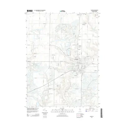
2015 Map of Canton
USGS Topo · Published 2015About this map
The city of Canton serves as the focal point of this 2015 survey, revealing a dense grid of streets and institutional landmarks characteristic of a regional Illinois hub. Education and transportation are prominent, anchored by the Spoon River Coll campus and Ingersoll Airport. The surrounding landscape is defined by a heavy concentration of cemeteries such as Greenwood Cem and Locust Lane Cem, providing a detailed record for genealogical research in Fulton County. To the north, the smaller settlements of Norris and Brereton are situated along the transit corridor. The map highlights a complex water network including Strode Lake, Veterans Lake, and Van Winkle Lake, alongside the winding paths of Buckheart Cr and Big Cr, illustrating how the local terrain has been shaped by both natural drainage and civic development.
Find a feature on this map
100 named features on this map. Tap any name to fly to it.
Don’t see what you’re looking for? This feature index may not catch every label — zoom into the map to look around manually.
Map Details
Editions of this 2015 Canton Map
This is the sole edition of this map. No revisions or reprints were ever made.
Other maps of this area

1912 · Canton
USGS Topo · 1:62,500

1925 · Havana
USGS Topo · 1:62,500

1929 · Manito
USGS Topo · 1:62,500

1930 · Glasford
USGS Topo · 1:62,500

1932 · Manito
USGS Topo · 1:62,500

1947 · Lewistown
USGS Topo · 1:24,000

1947 · St. David
USGS Topo · 1:24,000

1948 · Lewistown
USGS Topo · 1:24,000

1948 · St. David
USGS Topo · 1:24,000

1948 · Glasford
USGS Topo · 1:62,500