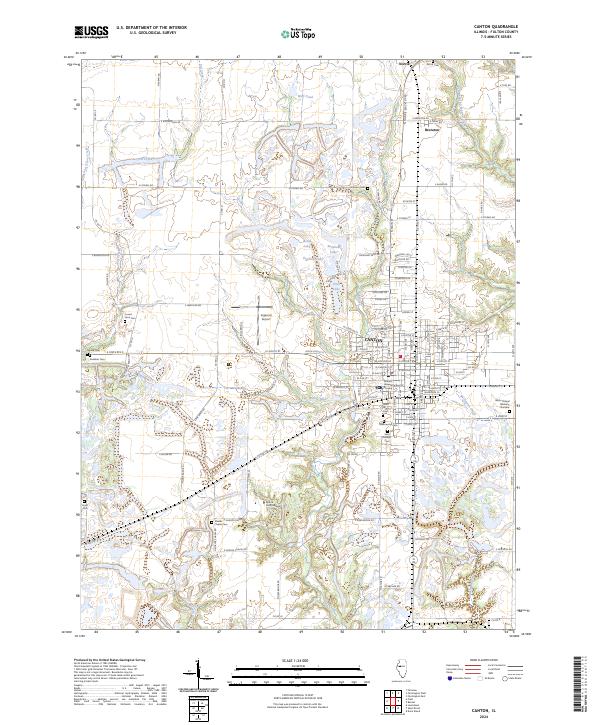
2024 Map of Canton
USGS Topo · Published 2024About this map
Canton serves as the central hub of this West Central Illinois landscape, surrounded by a complex network of small settlements and educational institutions. The map details the local academic and medical footprint through Spoon River College and the Graham Hospital School of Nursing. Outside the city limits, the terrain is dotted with numerous burial grounds of significant genealogical interest, including Shields Chapel Cem, Greenwood Cem, and Gardiner Cem, alongside the small communities of Norris and Brereton.
Find a feature on this map
120 named features on this map. Tap any name to fly to it.
Don’t see what you’re looking for? This feature index may not catch every label — zoom into the map to look around manually.
Map Details
Editions of this 2024 Canton Map
This is the sole edition of this map. No revisions or reprints were ever made.
Other maps of this area

1912 · Canton
USGS Topo · 1:62,500

1925 · Havana
USGS Topo · 1:62,500

1929 · Manito
USGS Topo · 1:62,500

1930 · Glasford
USGS Topo · 1:62,500

1932 · Manito
USGS Topo · 1:62,500

1947 · Lewistown
USGS Topo · 1:24,000

1947 · St. David
USGS Topo · 1:24,000

1948 · Lewistown
USGS Topo · 1:24,000

1948 · St. David
USGS Topo · 1:24,000

1948 · Glasford
USGS Topo · 1:62,500