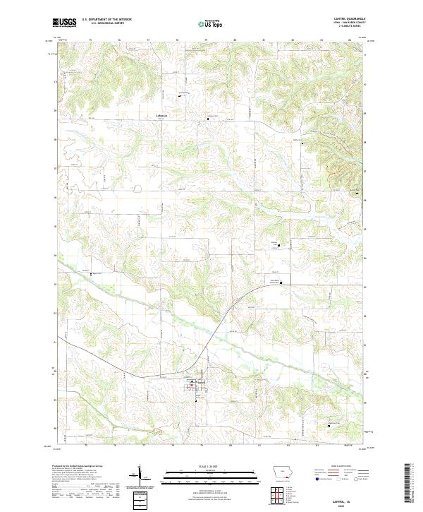
2022 Map of Cantril
USGS Topo · Published 2022About this map
The Fox River and its tributary system define the agricultural landscape of this Van Buren County region, where the town of Cantril serves as a primary hub. The map reveals a dense network of early rural markers, particularly a significant concentration of family and community burial grounds including Maple Grove Cem, East Home Prairie Cem, and the uniquely named Egypt Cem. These sites, often positioned near local drainage such as Big Indian Cr or on the rises above the river valley, offer a geographic record of nineteenth-century settlement patterns.
Find a feature on this map
64 named features on this map. Tap any name to fly to it.
Don’t see what you’re looking for? This feature index may not catch every label — zoom into the map to look around manually.
Map Details
Editions of this 2022 Cantril Map
This is the sole edition of this map. No revisions or reprints were ever made.
Other maps of this area

1954 · Centerville
USGS Topo · 1:250,000

1957 · Centerville
USGS Topo · 1:250,000

1958 · Centerville
USGS Topo · 1:250,000

1958 · Burlington
USGS Topo · 1:250,000

1961 · Burlington
USGS Topo · 1:250,000

1963 · Burlington
USGS Topo · 1:250,000

1965 · Selma
USGS Topo · 1:24,000

1965 · Douds
USGS Topo · 1:24,000

1968 · Keosauqua
USGS Topo · 1:24,000
1968 · Mount Sterling
USGS Topo · 1:24,000