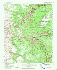
1955 Map of Canyon Del Muerto
USGS Topo · Published 1959About this map
Canyon del Muerto and the surrounding reaches of the Navajo Indian Reservation dominate this mid-century survey, revealing a landscape defined by its deep canyon systems and ancient archaeological sites. Within the Canyon De Chelly National Monument, the map identifies numerous prehistoric dwellings and landmarks, including the notable Massacre Cave Ruins and Mummy Cave Ruins. The survey documents a network of footpaths and routes like the Many Ladders Trail and Twin Trail, which provided access to the canyon floors and high plateaus before modern infrastructure expanded. Beyond the canyon walls, the sheet marks seasonal water sources such as Bear Spring and Glofer Spring, which were vital for life in this arid region. The presence of the Canyon del Muerto School reflects the localized community centers active during the 1950s, while landmarks like Spider Rock and Black Rock Butte serve as distinct navigational markers across the high desert terrain.
Find a feature on this map
47 named features on this map. Tap any name to fly to it.
Don’t see what you’re looking for? This feature index may not catch every label — zoom into the map to look around manually.
Map Details
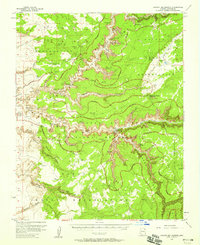
Editions of this 1955 Canyon Del Muerto Map
2 editions found
Other maps of this area

1886 · Fort Defiance
USGS Topo · 1:250,000

1892 · Fort Defiance
USGS Topo · 1:250,000

1892 · Canyon De Chelly
USGS Topo · 1:250,000

1954 · Shiprock
USGS Topo · 1:250,000

1954 · Gallup
USGS Topo · 1:250,000

1955 · Chinle 4 NE
USGS Topo · 1:24,000

1955 · Zith-Tusayan Butte 2 NW
USGS Topo · 1:24,000

1955 · Chinle 4 SE
USGS Topo · 1:24,000

1955 · Zith-Tusayan Butte 2 NE
USGS Topo · 1:24,000

1955 · Sonsala Butte 2 SW
USGS Topo · 1:24,000
Featured Places
- Chinle Agency, AZ
- Fort Defiance Agency
- Junction Overlook, Chinle Agency
- Del Muerto, Chinle Agency
- Apache County, AZ