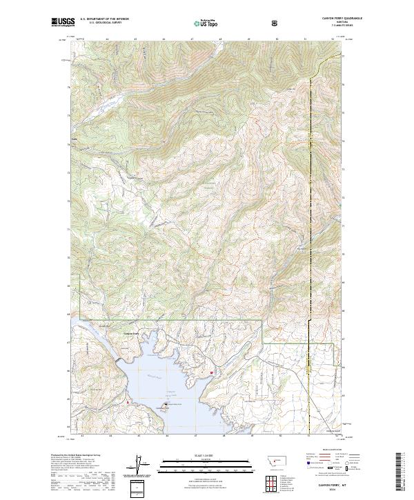
2024 Map of Canyon Ferry
USGS Topo · Published 2024About this map
Canyon Ferry Lake dominates the southern landscape of this quadrangle, where the Missouri River was harnessed to create a vital water resource along the Lewis and Clark and Broadwater county line. The settlement of Canyon Ferry sits near the dam site, while historical traces of the region’s development appear in the form of Canyon Ferry Cem and Cemetery Hill. The northern terrain is defined by the high elevations of Helena National Forest, featuring peaks like Hedges Mtn and a labyrinth of gulches including Kelly Gulch, Big Rattlesnake Gulch, and German Gulch. Cultural footprints of the area's mining and ranching history are evident in the placement of York and gravel bar features like Gruells Bar and French Bar along the river's original path. The map also records locally named landmarks such as Chinaman Cove and Cave Bay, which reflect the unique shoreline topography of the reservoir.
Find a feature on this map
84 named features on this map. Tap any name to fly to it.
Don’t see what you’re looking for? This feature index may not catch every label — zoom into the map to look around manually.
Map Details
Editions of this 2024 Canyon Ferry Map
This is the sole edition of this map. No revisions or reprints were ever made.
Other maps of this area

1886 · Fort Logan
USGS Topo · 1:250,000

1948 · White Sulphur Springs
USGS Topo · 1:250,000

1950 · Canyon Ferry
USGS Topo · 1:62,500

1950 · East Helena
USGS Topo · 1:62,500

1958 · White Sulphur Springs
USGS Topo · 1:250,000

1961 · White Sulphur Springs
USGS Topo · 1:250,000

1962 · Hogback Mountain
USGS Topo · 1:24,000
1962 · Nelson
USGS Topo · 1:24,000

1962 · Snedaker Basin
USGS Topo · 1:24,000

1965 · White Sulphur Springs
USGS Topo · 1:250,000