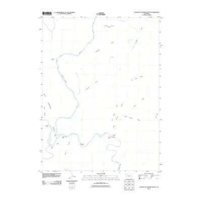
2010 Map of Canyon of Lodore South
USGS Topo · Published 2010About this map
The confluence of the Green River and the Yampa River serves as the focal point for this landscape in northwestern Colorado. Dramatic topography is defined by the steep-walled Canyon of Lodore, where the river winds past significant landmarks such as Triplet Falls and the towering Steamboat Rock. To the south, Echo Park and Box Elder Park offer relatively open spaces amidst the deep canyons and high ridges.
Find a feature on this map
32 named features on this map. Tap any name to fly to it.
Don’t see what you’re looking for? This feature index may not catch every label — zoom into the map to look around manually.
Map Details
Editions of this 2010 Canyon of Lodore South Map
This is the sole edition of this map. No revisions or reprints were ever made.
Other maps of this area

1885 · Ashley
USGS Topo · 1:250,000

1907 · Rangely
USGS Topo · 1:125,000

1907 · Jensen
USGS Topo · 1:125,000

1910 · Jensen
USGS Topo · 1:125,000

1910 · Rangely
USGS Topo · 1:125,000

1954 · Hells Canyon
USGS Topo · 1:24,000

1954 · Canyon of Lodore South
USGS Topo · 1:24,000

1954 · Canyon of Lodore North
USGS Topo · 1:24,000

1954 · Vernal
USGS Topo · 1:250,000

1955 · Stuntz Reservoir
USGS Topo · 1:24,000